Wild camping; your rights and the wrongs and perhaps what’s to come. Aug 2015.
I decided to write this blog post after posting a request on an open forum facebook page to report groups wild camping in the Brecon Beacons, and being “deluged” with some abusive, some clearly misguided and a few supportive comments. I also sought to clarify in my own mind as a solo walker, mountaineer and commercial operator who regularly uses the wild spaces of the UK, just what the position is regarding wild camping rights and wrongs.
It is no doubt a highly contentious issue, but it is also a very grey area with a plethora of contradictory advice available on various websites. Many people/organisations are also very reluctant to make any (official) comments about their policy in the face of some very strong public feelings on the matter. In my mind there is nothing better than setting out for the day with no real firm plan about where I am going to stay that night, it’s an adventure and ending up next to a murmuring river with a big starry sky above, far away from any light pollution or noisy neighbors, is generally an experience that stays with me for years to come. It cleanses my soul and recharges my batteries and is something I try to share with many of my DofE participants.
When I started wild camping, almost forty years ago in Scotland, it was a very different undertaking. I had to take the bus to the area I wanted to explore, I had to hack into remote areas on barely distinguishable paths, humping heavy and uncomfortable kit, set up my tent and perhaps take a couple of days exploring the area, or walking across it taking everything with me. Then get the bus or buses back which more often than not were full of folk who regarded you as generally insane, maybe because of the way you looked and smelt, especially if you and your rucksack were waterlogged and left a trickle of water running down the floor of the bus. It was not a weekend excursion.
Also, to be clear, you were always wary of being kicked off of your chosen camping spot by an aggressive Ghillie or jobs worth stalker who thought you might be there to have a wee punt at a trout or salmon. This happened to me on a number of occasions, it added to the overall uncertainty and therefore excitement.
It’s a different proposition today with lightweight tents and equipment, improved access roads, higher disposable incomes, increased leisure time, not to mention a dramatically increased (and steadily increasing) population. Companies (from car manufacturers to baby products) sell the idea of the outdoors as a lifestyle to aspire to; outdoor and holiday companies package our wilderness off and sell it to increasing numbers of eager consumers seeking to improve their skills, learn more about themselves by being part of a group in a demanding environment or just to have an adventure. Outward Bound, The Princes Trust, The Duke of Edinburgh’s award, a plethora of state and privately owned outdoor centers and an exponentially increasing number of private companies are competing with the individual walkers, mountain bikers, climbers, fell runners etc, for a slice of our Wild areas.
I am not condemning any of this; I am guilty on more than one count.
What are our rights to do this is an interesting question and whether we can continue to do so in an uncontrolled manner is an even more interesting one.
With rights come responsibilities, we will defend our perceived right to roam and use our wild spaces for our recreation and condemn the landowner who seeks to restrict these but what about the rights of our fellow users. Who protects the rights of the flora and fauna, which arguably have a stronger interest in the protection our rapidly diminishing wild spaces – maybe just as well they cannot speak, as I do not think we always listen to the bodies that speak on their behalf.
The Rights (In England and Wales)
Do a little bit of research about wild camping and you will find the following statement on a number of websites proffering you advice: “In England and Wales – wild camping is generally “tolerated” in remote upland areas “. Virtually all of these remote upland areas, I assume they are referring to, are our National Parks: Dartmoor, The Brecon Beacons, Snowdonia, The Peaks and the Dales, to mention the more obvious. I am not picking on any organization here, you will find these statements on many websites and in Outdoor magazines, the interesting word is “tolerated”.
However, visit the Peaks National Park Website: http://www.peakdistrict.gov.uk/visiting/getactive/camping for example and you will see the following “There is no provision under the Countryside and Rights of Way Act for camping on open access land. If you wish to wild camp in the Peak District National Park you must first obtain permission from the landowner before camping otherwise you will be committing a trespass”.
You will find the same or similar statements on nearly all of the individual National park websites.
I received an e-mail from Richard Ball, (Access Officer for the Brecon Beacons) one of the few people brave enough to put down his policy on paper and he advised: “We do not permit wild camping on our estate for a few reasons – “most of it is designated SSSI and we would need to gain consent from Natural Resources Wales, we have concerns about fouling and littering and almost all of our estate is common land so that third parties have rights over it, largely to graze animals”. And “In terms of controlling wild camping our wardens will move people on if they see them wild camping on our estate and will speak to them if they are camping on land owned by someone else and explain the legal situation”.
So what do the BMC have to say on the issue? They after all are the body concerned with protecting our “rights” and access.
https://www.thebmc.co.uk/wild-camping-worries
Some National Parks do welcome wild camping, as long as you act responsibly and leave no trace of your visit behind you. For instance, Dartmoor National Park has a map of areas where you can camp on common land. If in doubt, find an official campsite and do some preliminary research – there are some websites that recommend ‘remote’ camp sites and the National Parks website gives details of camp sites and camping barns in each of our National Parks.
So in Dartmoor (and perhaps still Snowdonia where there was a list published by PYB of wild camping sites) we have some areas where we are allowed to wild camp, however the general position is that unless you have the permission of the owner wild camping in not allowed. Some websites state that to do so without the permission of the owner is actually a trespass, which is a criminal offence. This law I understand has never been tested so perhaps some of these statements are questionable.
There is however a slightly different perspective on this, strictly from a legal position, in as much as unless the owner has expressly prohibited you from camping you are not actually breaking the law. However I am not a lawyer and do not make a statement about this.
The New Forest will also allow you to use some designated wild camp sites on common land provided you book and pay for them.
We always tend to look to Scotland as the shining beacon of access rights for enjoying the hills and wild spaces and the policy for this is laid out in the Scottish Access Code, which states. “Access rights extend to wild camping. This type of camping is lightweight, done in small numbers and only for two or three nights in any one place. You can camp in this way wherever access rights apply” It does however go on to say: “does not include camping on organised camp sites or with groups such as the scouts or guides”
However there is also one word that is not included in this quote but is evident throughout the code and that is “responsible”, this is something of a key word as things which are considered irresponsible fall outside of this code, a rather vague classification. We are all aware of the Draconian introduction of new By Laws prohibiting wild camping in Loch Lomond and the Trossachs National Park which fundamentally challenge a perceived age old right, and, in my opinion, do not address the issue but punish the many for the actions of a few. However, I would doubt that many are aware that some of the largest estates in the Cairngorm National Park have, and others are considering starting, a booking process for groups using “honey pot” campsites. The Balmoral Estate, for example, now limits DofE numbers by insisting that they book the wild sites at Loch Muick. Any groups found to be not following the booking process are reported by the rangers, to the local DofE Office. This policy has been instigated by necessity due to the steadily increasing numbers visiting the area. The landowners are not operating outside of the access rights, as these “rights” do not extend to organised groups. The problem they are addressing by doing so is overuse and sadly misuse by groups. In 2014 the DofE had over 250,000 new starters and of that there were 30,000 at gold, that’s around 240,000 nights spent in our National Parks (where gold is generally undertaken) camping either wild or in remote farm campsites.
So it can be seen here that even the bastion of perceived access rights is changing and that policies are being changed to counter problems that are generally caused by over use and a few rogue operators. I am not referring here to the actions of the irresponsible who camp next to the road and leave a mess but the growing problems of (generally commercial) group use.
Our Responsibilities
Guidelines for responsible wild camping are easy to find and most outdoor users are familiar with the quote: “Take nothing but your memories, leave nothing but your footprints,” and its easy to say that as an individual we do so, however the almost indisputable fact is that in order to do so we should be taking out our own waste, toilet paper and any uneaten food. I spoke to a BMC access officer who maintained that this is best practice; do you comply?
Human waste is harmful to the environment, it is not like a herbivore’s waste in as much as it contains chemicals which do not biodegrade but build up in the ground, and into the plants and eventually the flora and fauna.
When you decide to camp next to a river or in some remote spot have you checked if the area is currently hosting a rare or easily disturbed bird’s nest, say a Hen Harrier or a Dipper. Your presence or especially that of a noisy group could cause distress or the bird to abandon the nest. How do you check? Well you follow the parks guidelines about where you can and where you should not camp, unless of course you are attuned to what is going on around you and are watching for signs of distress in the wildlife. Dartmoor, for example, will close off areas of the park to camping for this very reason.
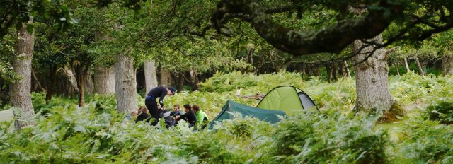
A solitary individual or a couple sticking up a tent late at night, away from sight, sitting quietly enjoying the solitude are unlikely to cause any permanent damage or distress: they are up and away early the next day taking everything with them; I cannot see why anyone would challenge this or criticise it. However descend on an area with more than two or three tents, run about making a noise, wash your dishes in the river discarding food waste in the process, dig shallow holes in the ground for your human waste and you are not being responsible, especially if this site is being used regularly by groups. The build up of human waste itself will cause an issue, it takes up to 45 days to biodegrade and longer in a cold climate.
Just because you think your small group is not creating an issue think about the same site being used again and again and again. I have seen areas of the Khumbu being turned into something resembling a landfill site in the space of ten years. If you want to be responsible the best way is to check with the Park Authorities about where and when you can camp. No climber I know would dream of climbing on the Pembroke shire sea cliffs when there is a bird ban in place. No one with any degree of sense would dream of camping on Dartmoor firing range when the red flag is flying, so why do we choose to ignore the parks’ guidelines other than perhaps arrogance in the belief that the laws do not pertain to us and the age old suspicion that it is a landowner trying to exert their influence over our (actually questionable) rights.
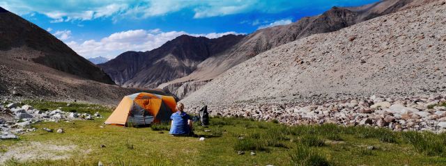
As a solitary walker I go to Snowdonia and Scotland to fill my soul with the wilderness and camp where I like but as far away from everyone else as I can possibly find. I follow the code and take and leave nothing. I will never condemn or seek to criticise anyone else who does so provided they are doing so responsibly.
As a commercial DofE operator taking hundreds of participants into the wild areas of our country I always follow the guidelines set down by the park and the local DofE panel. I may well be changing some of the other ways in which I operate after researching for this blog. Using the Brecon Beacons I do not allow my DofE groups to wild camp as: 1. The DofE panel will not pass my routes if I do so, and, 2. I know it is against the park guidelines and I do not want to antagonize any landowners and thereby bring my company and the DofE into disrepute.
I condemn other commercial users, especially with groups, who do not follow the guidelines and who camp irresponsibly, as they create issues for many other users, especially as there is no real need to do so. To say that not being allowed to wild camp in some of our parks reduces our ability to introduce our young people to the great outdoors is nothing short of nonsense.
You can walk all day and then stay at a remote farm campsites (of which there are many) that you will have to yourself and hear nothing other that the hoot of owls and the rush of the river you are sleeping beside. There, at least you do not have to package up and carry your poo out and you can dump your garbage responsibly; you are also helping the farmer.
If you desperately want to wild camp then go to Dartmoor or Snowdonia but follow the responsible camping and the park codes.
Times are changing and the access laws are being debated in Wales even as you read this; it is not just walkers and commercial users that have the right to suggest change, the landowners have exactly the same right, and by abusing our wild spaces (which they own) it encourages them to do so.
Some of the fundamentals of our “rights” to wild camp in the UK have been changed in the past twelve months alone and it is difficult to object to these landowner driven changes when they can point to the irresponsible use of their land, as the reason the change is necessary.
I think some of the commercial operators and those who work for them have a big responsibility to get their house in order, before they can object to restrictions in the use of our wild spaces.
Diary of a Munro Bagger 36 – 32 August 2015
The journey north was taken at the drop of a hat, weather watching and diary commitments are part of life, to date the two had not coincided to make the drive worthwhile. We left Frome at 1200 on Sat and were in Craig by 2300, not one hold up along the way. However the current average speed cameras for the whole length of A9 did frustrate, especially as the road was empty of any other traffic.
Up and at em on the Sat morning we decided to set our sights on two hills in the Coulins just north of Achnashellach railway station. This area was new to me, I had not been into it before. The sun shone as we made our way into the area on a beautifully constructed stalkers path, the east ridge of Beinn Liath Mhor rose steeply above us and we wasted no time in grunting our way up and gaining the east top. The 1.5 Km ridge undulated away to the west, a good mix of easy ground with some short precipitous sections.

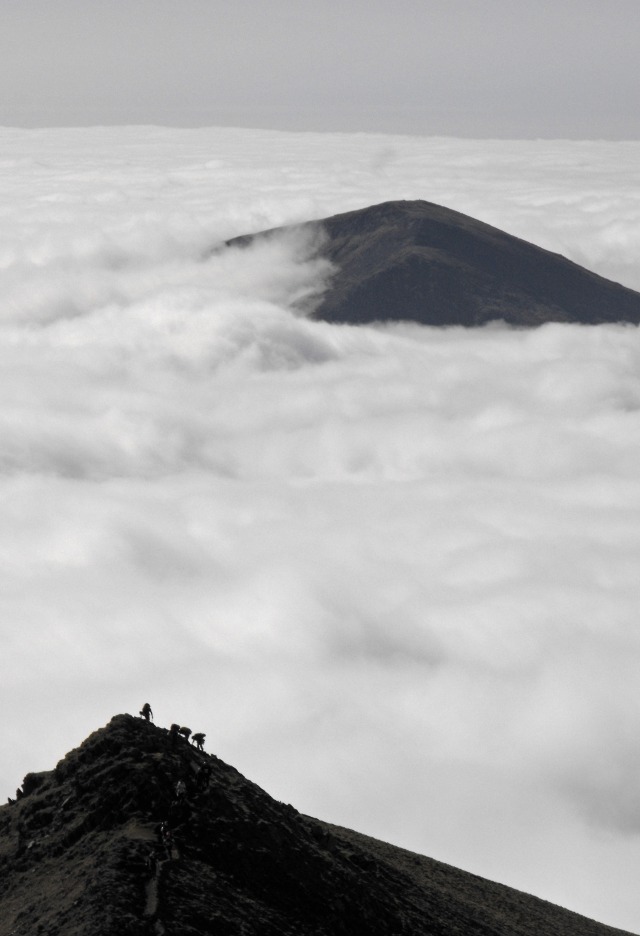
Sgurr Dubh, not looking black at all but lit by the sun against the darkness of the Torridon hills to the north.
The weather changed and brought some heavy cloud which sat just above the tops, a brisk chilly breeze blew some light drizzle into our faces. The sun shone through in places lighting the hills around us, defining the three dimensional nature of the rugged terrain. The Torridon hills just to the north looked dark and foreboding but the views to the west were still exceptional in their own way. We dropped down to the col and then went up and onto Sgorr Ruadh the summit of which had been hidden by cloud since we started.
Remarkably by the time we arrived the clouds had cleared and we had stunning views, however the cold wind remained and we did not tarry long but made our way down onto the flat ground under Fuar Tholl and by way of another superb stalkers path back to pick up the initial access track of the day.
We picked up the van and drove out to a lay-by with a view of the setting sun to cook and eat our dinner.
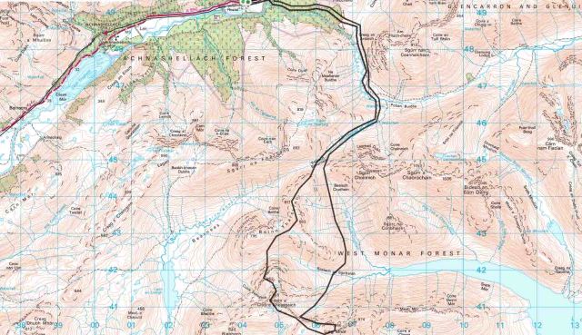
Next morning we were up at 0500 with a massive day in our sights, from Craig we walked into the Pollan Buide, the rising sun full in our faces and lighting the hills from the previous days wanderings with a beautiful soft light.
From the wire bridge which crosses the river we climbed to the Bealach Choire Choinnich on another lovely stalkers path and from there made our way south to the top of Beinn Tharsuinn. By now it was 1100, we had been going for 5 hours. The improbable looking cliffs of Bidean a Choire Sheasgaich ( Cheesecake ) lay in front of us. We dropped to the col and made our way up, the path stopped at a 5m rock face split by a little chimney running with water, hmmm, we forced our way up it, hearts in mouth and then by way of a steep grassy gully gained access to the summit ridge.
The sun was still shining as we stopped for the obligatory summit picture and a quick bite to eat before making our way along to Lurg Mhor one of the most remote munros in Scotland. By now it was 1500 hours and we had been going for 8 hours. We chose to drop down to Loch Monar and make our way back up to the col we had come from. This was not an easy journey, we traversed the rough ground beneath Tharsuinn, crossing many river gullies on the way. The weather had deteriorated and it was now raining, the chore was made just a bit more bearable by the fantastic flora, sundew, orchids, aspidals and violets were abundant about our feet. Eventually back at the col we reversed our footsteps of the morning arriving back at the van some 13 hours after setting off. 29K and approx 2000m of ascent and decent had made our feet ache and our bodies weary, we ate and crashed.
The next day took us back into the Coulin for an ascent of Maol Chean dearg, again the sun shone for us again but the experience was not really like a Scottish one at all. The paths are white quartz, more like walking in areas of the alps, the top of the hill is a jumble of red sandstone boulders which is in complete contrast to the early days wanderings.
However five tops ticked we made our way back to the van and back down the road. A most excellent way to prepare ourselves for the Pyrenees next week
A recce in the Rhinogs Aug 2015
The Snowdonia national park has around 10 million visitors a year of which approximately 500,000 will make the pilgrimage to the summit cairn of Snowdon itself, whether its by foot or by train. ( figures taken from the National Park Website ). Thats approximately 1500 every day, this does not make it the ideal place to escape the madding crowds, you might be better going to MacDonald’s.
Generally you do not have to go that far from Snowdon to escape the hoardes, the northern end of the Carneddau or the Nantle ridge can provide an excellent escape where you can undertake a good walk and bump into only a handful of likeminded individuals, we had done these walks many times so throwing caution to the wind Jane and I decided to become devil may care explorers and head to the far flung southerly reaches of the park and explore a couple of areas we had not visited before.
Embarking upon our quest with a planned ascent of Cadair Idris we decided to start late as the forecast for the morning was foul, we started excellently, the ticket machine in the NT carpark was out of order, £4 better off and feeling smug we started off up the hill in heavy rain in the hope that we would be on the summit as the weather cleared.
It may not be Snowdon but it still attracts its fair share of numpties, 30mph winds and heavy rain aside the majority of our fellow explorers were dressed in trainers and shorts, we passed one man with two kids, one of whom was too young to walk and was sitting on his shoulders ( it might have been a smurf as it was predominantly blue ) who should have been reported to childline. The best one was a group of teenagers in shorts and t.shirts who had bin bags as waterproofs, fair play, they had a map but didn’t actually know which hill they were on and were happy to be shown the way down.
We made the summit in heavy rain with 10m visibility, we left the summit in heavy rain and 10m visibility, we arrived back down at the car just as it started to clear and we could actually then see what we had climbed. It looked great, the warden told me the views from the top are excellent, our smugness had long since evaporated unlike the water running out of my boots, maybe another time.
We exchanged our wet togs for dry ones, had a cup of coffee and drove up the road to park the van at an access point to the Rhinogs.
The only thing I knew about this area was that there was a nuclear power station and that there was a healthy population of goats. I wondered to myself if the animals had been affected by the radiation, glowed in the dark and should perhaps be called Gloats.
Next morning the sun was shining, the ground was steaming and the summer air was heavy with the smell of wet earth, the buzzing of bees and the cries of a plethora of avian life, whats more there was no-one else around.
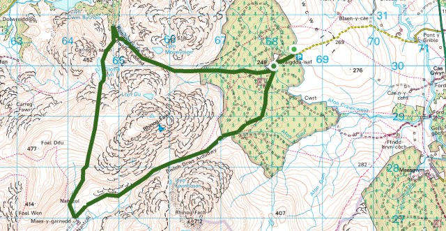
I had forgotten the 1:25 map and we were using a 1:50 borrowed in haste from my mate Henry so we decided not to head for the summits but instead to do a circular walk through the hills. Ostensibly we were actually there to see if we could suss out the areas suitability for a new Gold DofE venue so this did make sense, it did not however appeal to my summit fever personality.
However as we gained the higher ground outside of the forested area I was glad of our decision, the ground is some of the roughest I have come across anywhere in the UK, its a jumble of boulders, deep heather, blaeberry plants and at this time of the year is generously covered by a healthy growth of strong bracken, a real ankle breaking fest if ever there was one. We crossed the ridge to the north of Rhinog Fawr and descended to Bwlch Tyddiad on a beautifully constructed path called the Roman Steps ( why it is called this I have been unable to find out ). A rough path then took us upwards past Glow Llyn to the ridge descending from the rocky castellations of the 720m summit of Rhinog Fawr.
The summit tempted me but I kept my head pointed south and made my way down to the hamlet of Nantcol crossing some horrible ground on the way by being unable to find the path ( I blame the 1:50 map ) There is a car park at Nantcol, well a farm which charges you £3 a day to park so you can access the area from this point as well.
We turned east and headed up to the col between the Fawr and the Fach on thankfully another well made path, the ground on either side of us rising to seen and unseen summits did not look appealing, steep, vegetated, border strewn and no path in evidence. I know the summits can be accessed from this point and that a full traverse can be undertaken but I am not sure I would actually enjoy the experience, especially at this time of the year.
From the col we dropped back down into the forest and followed the access tracks back to the van. Only 14K, approx 800m of ascent and my legs felt like I had had a good mountain day out, whats more we had bumped into only a couple of folk on the Roman steps but otherwise had had the hills to ourselves.
This is an area of the National Park that is largely ignored, maybe because of the marauding gloats, maybe simply because of the nature of the ground, maybe because its too far away from the Honeypot areas, from a selfish point of view however long may that continue to be the case.
No summits ticked but a fantastic day out nonetheless
Condemnation of the inappropriate use of tracking systems in the DofE and the insidious creep of the Health and Safety culture. June 2015.
“The DofE gives all young people the chance to develop skills for life and work”
This is taken from the home page of the DofE website and is part of their mission statement. I would argue that two of, if not the most important learnings to be derived from the expedition section of the DofE is self reliance and the ability to manage risk.
What skills could be more important in terms of life and the world of work.
It is our duty as DofE leaders and supervisors to appropriately train, give confidence to and therefore allow our charges to take control of the situation in which they are operating. We should not seek to eliminate the risk but to manage it appropriately. If we eliminate the risk we deprive the participants of the ability to manage it and therefore gain confidence in themselves.
Inappropriate use of satellite trackers do just that. I can see the advantages of tracking groups when you first let them “off the lead” to test their newly found navigational skills, especially at Bronze or where you are training a group of Gold direct entrants. However I would argue that when groups are being assessed trackers should not be used and if they are groups MUST not know they are being tracked. How are they to develop a feeling of self reliance if they know they will be rescued if they make a mistake. As the DofE advises in their handbook “care must be taken to ensure thay they do not compromise the groups feeling of self reliance”.
After all if a group has to be rescued they did not complete an unaided expedition and therefore did not meet one of the twenty conditions.
Too many times I have seen these systems being inappropriately used. Once I watched a group of teachers huddled around a laptop in a coffee shop as they watched a group go round in round in circles on the screen and laughing as they said “should we go and rescue them, no let’s let them learn a lesson ” What lesson is that then ? That the DofE is enjoyable ?
On another occasion I watched two supervisors sitting in a van in a campsite in the Brecons watching the screen as the group got their nav wrong, crossed several private field boundaries (where there are no stiles) came to the main road at a point which is deadly to cross and just waited for them to reach the campsite. They commented to me “well that will teach them to pay more attention” How do either of these uses increase safety or the group’s ability.
The only way to correctly supervise a group is to be out on the hill watching them. That way you can see what they are up to, if they are behaving appropriately, if they are operating as a team or if one of them is struggling. If you do not have enough instructors who are capable of appropriately supervising the number of teams you have out there then you are misusing trackers as the DofE clearly states, “they should not be used to reduce the number of instructors to safely manage the groups”.
Lets be clear, the DofE handbook states that ” If the team does not possess the necessary physical, first aid and expedition skills required … then they should not be in that area” as part of the 20 conditions. So if we have doubts of the team’s ability to cope with the environment in which they are operating we should pull them. Otherwise we are simply allowing them to get an award that they do not deserve. Similarly if we know they are unable to navigate, behave properly or look after themselves then we should be ensuring that the distance supervision we are giving them is more comprehensive, in short we should be out on the hill.
What is wrong with a group getting lost and putting their emergency procedures into practice, they have tents, they have food; if they have been properly briefed on what to do then there is no real risk.
Who are we seeking to protect with the use of tracking systems, I would argue it is our own backsides. The groups do not receive any benefit from their use as the DofE also states “They should not be used for the day to day monitoring of the group” so by my understanding they should not therefore be used to give feedback on a group’s performance. They do not improve a group’s ability to cope with risk or give them a fundamental feeling of self reliance.
No the only people they protect are the groups supervisors who cannot be bothered to get out on the hill with the groups or who, are sometimes forced to, cut corners in the numbers of appropriately trained staff to supervise the number of groups they have. It is our duty as DofE leaders to uphold the integrity and the benefits of the expedition section of the award and if we fail to do so through the inappropriate use of technology we are depriving our kids of the benefits they should be receiving.
Too often I hear the glib excuse “at least we are getting them out in the country” that does not stack up in the context of the award. They could be out on a venture program or on a survival weekend or similar instead of an award expedition for which they do not possess the skills or the fitness required.
I for one do not use them, I work with schools who do not want them to be used and who want their kids to be well trained and benefit from a feeling of isolation and self reliance thereby gaining confidence in themselves and their own abilities.
In my opinion it is just the slow steady creep of the H&S culture through fear, the dumbing down of the expedition section of the DofE and a further reduction in teaching our kids to appropriately manage risk.
Rest day wanderings in Andalusia 5th January 2015
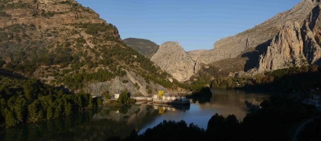
We rose relativly early, the sun was still weak and the air temperature was chilly, the dam and hydro electric station below us murmured and hummed away and provided an audible companion to the wind sighing in the olive groves that surrounded the little cottage we were staying in.
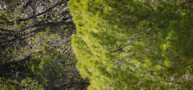
Too chilly, even in the hard low wintery sunshine, to hang about we set off up the road and into the National Park grounds, the road underfoot changed from tarmac to compacted gravel and the pine trees enveloped us and protected us from the chilly breeze. The sensations went through a paradigm shift, the light was now soft and dappled, the temperature warm and the sounds a soft susurration around us. The Mediterranean pines, softer than a Greenfinches wing, made our own, and imported versions, in the UK look loutish and harsh by comparison. Above us in the branches the downy murmuring from a flock of unseen birds faded away as they took flight from our alien presence in their woods.
We continued on up the path under and through the trees and the dappled light till we emerged once again into a world of strong sunlight. The sun had strengthened by now and the early morning wind had dropped giving us an ideal temperature in which to wander on. The track we followed was lined with miniature iris’s, their iridescent blue and yellow short lived flowers providing the perfect foil to the lush green of the Andalusian spring growth surrounding them.
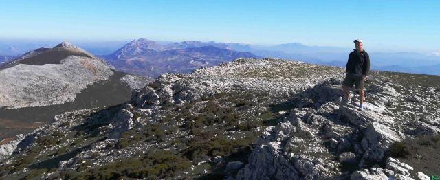
Above us massive bearded vultures climbed languidly in the early morning thermals rising from the steadily warming limestone cliffs, a four foot snake slithered across the track in front of us causing Jane to jump, more than just a bit. We passed little whitewashed farms, where the dogs barked and the chickens ran away and we entered the world of the high Spanish springtime sierras. On and up, on and up we went, leaving the track to climb the slab by limestone ridge to access the summit of the Sierra de Huma.
By now we were into another world, one of harsh sunlight, low single figure air temperatures and a harsh altitude enhanced sunlight. A light fleece was enough to keep the cold at bay and provide us with comfort to tarry a bit and enjoy the view. To the east the snow capped tops of the Sierra Nevada shone in the distance whilst to the south the Mediterranean resembled a flat board. We were on our own, no one to be seen or heard our only company the vultures circling around the cliffs way below us.
We ate a little lunch and started dropping down to a warmer and more hospitable world of farmland and human habitation.
My fingers rested tomorrow it would be back to climbing.













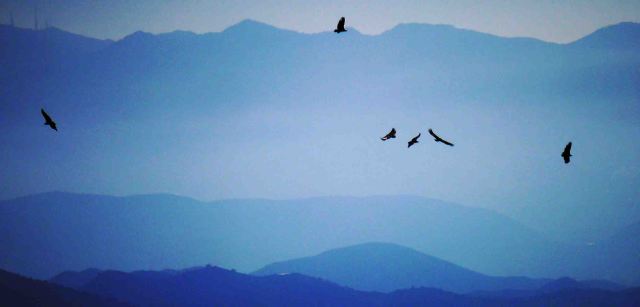

Those look more like Griffon Vultures, Bearded have a more prominent diamond shaped tail.
Only going by the notice board in El Chorro that states that the cliffs are home to a colony of Bearded Vultures, I will bow to anyone’s superior notice, the only vultures I can recognise are those in the Inland Revenue.
I have been following a dicussion on the use of trackers and think you have done an absolute brilliant job of explaining ‘why not’ and the benefits to be had from a properly organised, properly trained and properly supervised expedition. Your thoughts are so inline with my own. Robert McPhee – Accredited Assessor and Explorer Scout Leader.